
- This event has passed.
June Women’s Group Hike
June 13 @ 10:30 am - 1:00 pm

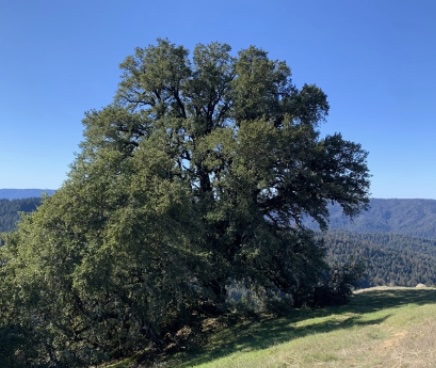
Location: Santa Cruz Mountains: Mother Tree & Turtle Rocks
Date: Saturday, June 13, 2026
Time: 10:30am – 1pm
Screenshot
In June, we are heading to “Turtle Rocks” and the “Mother Tree” on Long Ridge Trail in Midpeninsula Regional Open Space in the Santa Cruz Mountains. This easy, short trail has views to the ocean and beautiful, lush forest, with option for a longer hike or, no hike at all!
About the Hike
- The hike is 0 or 2 or 4 miles
- This trail is a short way from Frances Mann-Craik’s house – so we’ll meet up at her house and proceed to the trail head (or just stay at the house and sit in the sunshine!)
- Easy, flowing hills
- Sorry, No dogs allowed
- Restrooms at Frances’ house
- Men are welcome on the hike as guests of women’s group participants
What to Bring
- Water
- Around 50% of the hike is in the shade. As always, it is good to have a hat, sunglasses, and sunscreen, bug spray. It can be a bit windy, so pick a hat that will not blow off.
- Lunch — Bring your lunch and after the hike we’ll sit on the deck and enjoy each other’s company.
Meeting Location
- Meet at UPA at 9:45AM to self-create car pools.
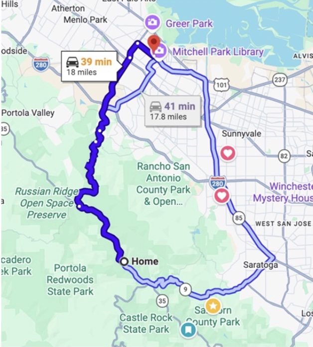
- Put the address – 11885 Skyline Blvd., Los Gatos, CA – into your Maps program before you leave – there is often no cell coverage here.
- 10:30 AM meet at Frances’ House (We will park at Frances’ house and carpool just 1/3 mile to the trail head.)
- If you are interested in carpooling, you can mark that on the form.
Screenshot
Driving Directions
From Woodside and North / Highway 84:
- Take Highway 84 (La Honda Road) West from Woodside.
- At the TOP of the mountain, at Sky Londa, turn left (South) onto Skyline Blvd (Highway 35).
- Drive South for about 11.8 miles – you’ll come around a corner with a big rock and lots of arrows, then a straight away. Go past the big rock. You’ll see signs for Jikoji Zen Center on the right. Our driveway is on the left, just before the Jikoji road. It has double white mailboxes. Take the driveway, then go left at the “Y” and park anywhere.
From Palo Alto – via Page Mill Road (OR Highway 9 – see below):
- Start: Head west on Page Mill Road and drive to the top of the mountain.
- At the top of the mountain there’s a stop sign. Turn left (South) onto Skyline Blvd (Highway 35).
- Drive South for about 4.5 miles – you’ll come around a corner with a big rock and lots of arrows, then a straight away. Go past the big rock. You’ll see signs for Jikoji Zen Center on the right. Our driveway is on the left, just before the Jikoji road. It has double white mailboxes. Take the driveway, then go left at the “Y” and park anywhere.
From Palo Alto and South – via Highway 9 from Highway 85:
- Start: Take Highway 85 to Saratoga Avenue and Head West (or South) on Highway 9 (Big Basin Way) – STAY ON THIS ROAD and go to the very top of the mountain to the four way stop at Skyline Blvd (Highway 35).
- Turn right (North) onto Skyline Blvd (Highway 35).
- Drive North for about 1.9 miles – there’s a straight away and you’ll see signs for Jikoji Zen Center on the left. Our driveway is hidden, it’s on the right with double mail boxes. Take the driveway, then go left at the “Y” and park anywhere.
- Park at the Y in the driveway by the big white truck, or alongside the driveway (no one will tow you!)
Questions: Contact Frances: manncraik@gmail.com or 408-499-9098